
The West Mine
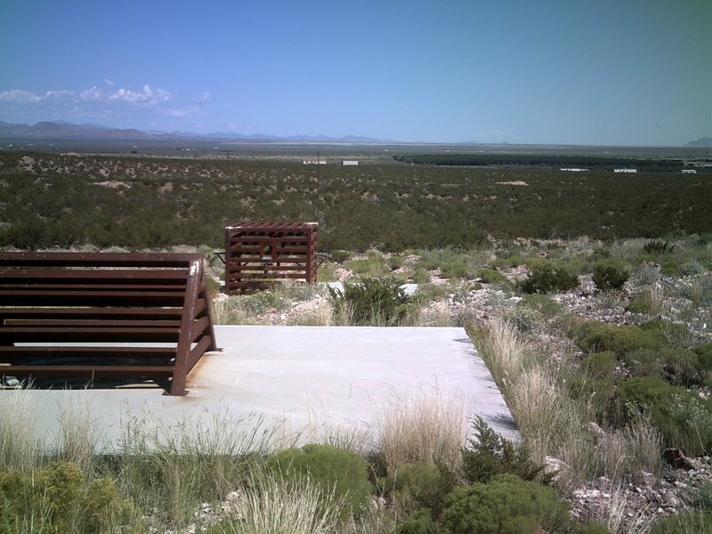
While Coyote Arroyo slumbers in quiet isolation, camouflaged by brush and grass, The West Mine sits out in the open. A concentrator mill was located here and as a result it has a more industrial look to it. Leaching ponds, tailing piles, a concrete tank & concrete abutments are the most prominent features. The concentrator mill was erected by the Luna/American Group in 1923, but the gravity concentration was not efficient and the mill was eventually closed. The mines at the site consist of an inclined shaft, an open shaft and a timber lined vertical shaft. The latter shaft, while unimpressive from the ground, plunges five levels into the earth with 2,000ft. of drifts. The mine has it's quirky features like the two dugout shelters that miners built into the slope. There are two of these shelters and they have weathered the years fairly well. The craggy outcrop that looks down on the mine is called the "Indian Post Office" your guess is as good as mine as to why. The plant sprawls out over a large area, with a couple of winding roads leading to and around it's various features.
 The West Mine was owned and operated by the Luna/American Group (they also owned the less productive Killion Mine at Black Rock Canyon). Production started in 1919 and continued until 1955. Most manganese mining in New Mexico ended in the late 1950's, after the U.S. Government halted it's manganese buying program.
How to get there: refer to instructions for Blackrock Canyon
Worth the Trip? Yes
Roads: Rough
Public or Private: Public
Mine Danger: High (open vertical shafts, stope)
Snake Danger: High The Spar Group Mines
The Spar Mines are part of the Blackrock Mining District (also known as the Little Florida Mining District). The mines sit at ground level, appx. 2.0 miles due east of the Little Florida Gap. The Spar mines include the Florida Fluorspar Mine, from which the majority of fluorite and barite in the district was mined. The New Mexico Bureau of Mines and Mineral Resources lists the years of production as 1919 to 1951, however the New Mexico AML (Abandoned Mines & Lands) Program that safeguarded the site in 2003 lists the years of production as 1890 to 1960.
 Before the openings were secured the site was in dangerous condition. Over twenty deep stoped shafts and pits dotted the area. It's a much different place now, the tailings piles and dumps were used as backfill, only a small trash dump and the remains of a wood frame building litter the site. Several of the openings connect underground, making them ideal habitat for bats and owls. The main shaft sits elevated on a small berm, it's surrounded by a concrete support wall. This shaft drops to 150+ ft. and connects to a large multi-level stope system. Because of this four of the open stopes were enclosed with bat and owl compatible cupolas.
 How to Get There: take Highway 549 east, 10 miles east of Deming, turn south onto driveway marked 10910, cross cattle guard, continue south, turn right (west) onto 1st. pipeline road follow this road to large earth berm, road forks, turn south again, follow road across 2nd. pipeline road, continue south to the mines, appx. 1.5 miles from highway.
 Worth The Trip?- Yes
Roads- Dirt, Two Wheel
Public or Private- Public
Mine Danger- None
Snake Danger- Show Caution


How to get there: refer to instructions for Blackrock Canyon
Worth the Trip? Yes
Roads: Rough
Public or Private: Public
Mine Danger: High (open vertical shafts, stope)
Snake Danger: High

The Spar Mines are part of the Blackrock Mining District (also known as the Little Florida Mining District). The mines sit at ground level, appx. 2.0 miles due east of the Little Florida Gap. The Spar mines include the Florida Fluorspar Mine, from which the majority of fluorite and barite in the district was mined. The New Mexico Bureau of Mines and Mineral Resources lists the years of production as 1919 to 1951, however the New Mexico AML (Abandoned Mines & Lands) Program that safeguarded the site in 2003 lists the years of production as 1890 to 1960.


Roads- Dirt, Two Wheel
Public or Private- Public
Mine Danger- None
Snake Danger- Show Caution

No comments:
Post a Comment